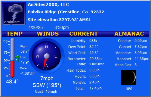
Ideal is light South wind, but SE to W is acceptable. Bad if 5+ mph North at Crestline.
By order of interest:
| Description |
Latitude |
Longitude |
Altitude (ASL) |
Orientation |
| Andy Jackson (Main) LZ |
N 34.1934° |
W 117.3234° |
519 m |
1702' (NE corner. Ken Howells, 2016/10/9) |
Any |
| Top of training hill at NE corner of LZ |
N 34.1949° |
W 117.3214° |
542 m |
1777' (Rob McKenzie, 2018/5/30: 75' over NE corner of LZ) |
SW |
| 350' launch |
N 34.1972° |
W 117.3205° |
625 m |
2052' (About 350' over LZ) |
SSW |
| 400' launch |
N 34.1972° |
W 117.3196° |
641 m |
2102' (About 400' over LZ) |
SSW |
| 750' launch |
N 34.1998° |
W 117.3170° |
756 m |
2480' (Ken Howells, 2016/10/9) |
SSW |
| 1100' launch |
N 34.2032° |
W 117.3174° |
854 m |
2802' (About 1100' over LZ) |
SW |
| Regionals launch |
N 34.2095° |
W 117.3200° |
1034 m |
3391' (Approximate, from Google Earth) |
SE |
| Marshall launch (PG, center of slope top) |
N 34.2100° |
W 117.3029° |
1211 m (GPS*) |
3973' (GPS*) |
SSW, SW |
| Crestline launch |
N 34.2360° |
W 117.3130° |
1604 m (GPS**) |
5262' (GPS**) |
S |
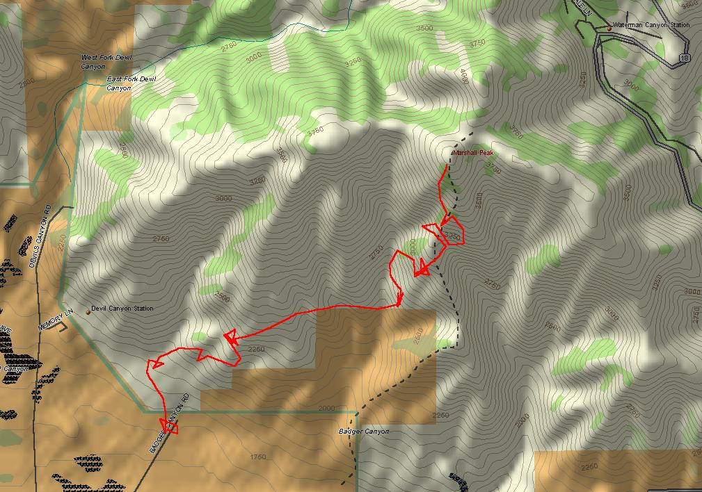
| Devil Canyon bail-out LZ (Coming from Crestline) |
N 34.2117° |
W 117.3295° |
706 m |
2315' (Approximate, from Google Earth) |
Any |
| Mount McKinley (1st decent mountain East of Marshall) |
N 34.1659° |
W 117.2035° |
1158 m |
3800' (Approximate, from Google Earth) |
N/A |
Mount Harrison (has a flat top ridge, 2nd decent mountain
East of Marshall and before the Santa Ana river dam) |
N 34.1649° |
W 117.1601° |
1445 m |
4741' (Approximate, from Google Earth) |
N/A |
| Santa Ana river dam LZ area |
N 34.1025° |
W 117.1073° |
570 m |
1869' (Approximate, from Google Earth) |
Any |
| Hangar 24, Redland Municipal Airport |
N 34.0824° |
W 117.1427° |
477 m |
1563' (Approximate, from Google Earth) |
Any |
* GPS = Br�uniger / Competino, using WGS84.
WGS84 (World Geodetic System 1984) is the Standard Geodetic Datum & the common reference datum
used for civilian aviation world wide.
More info:
|
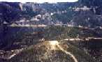
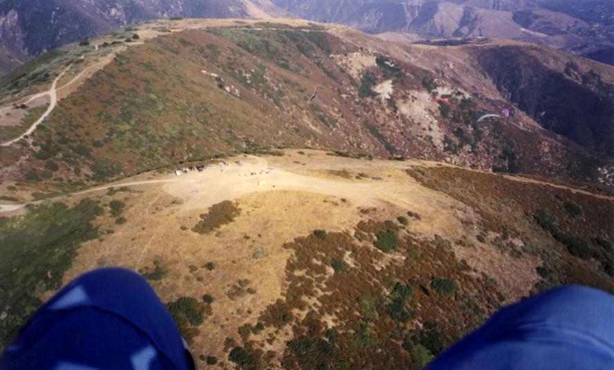
1998/3/1
|
Looking back at launch and Crestline in background.
|
|
Regardant par en arrière le décollage
et Crestline en arrière-plan.
|
|
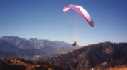
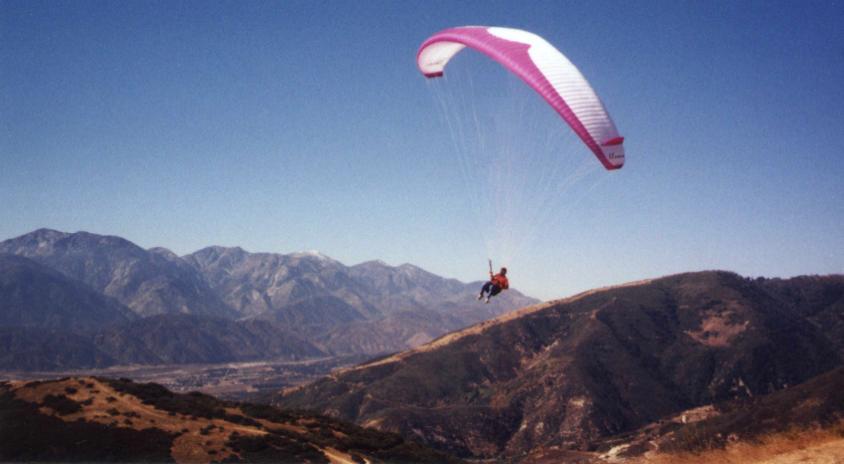
1998/11/14
|
My new Advance/Omega 4.
|
|
Ma nouvelle Advance/Omega 4.
|
|
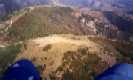
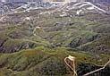
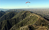
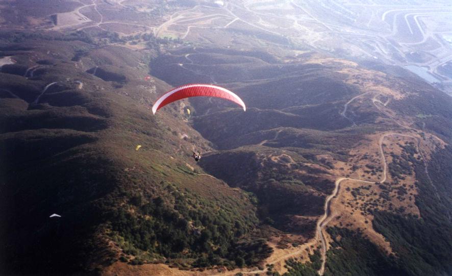
1999/8/14
|
Over launch.
|
|
Au dessus du décollage.
|
|
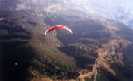
1999/8/14
|
Over Cloud looking towards LZ.
|
|
Au dessus de Cloud regardant vers l'atterrissage.
|
|
Dam Race Pictures
|
2001
|
Pictures of the Dam Race.
|
|
Photos du Dam Race.
|
|
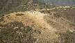
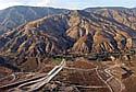
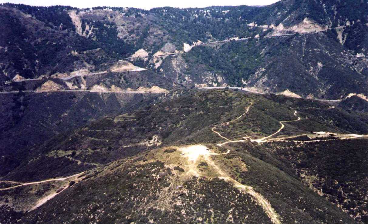
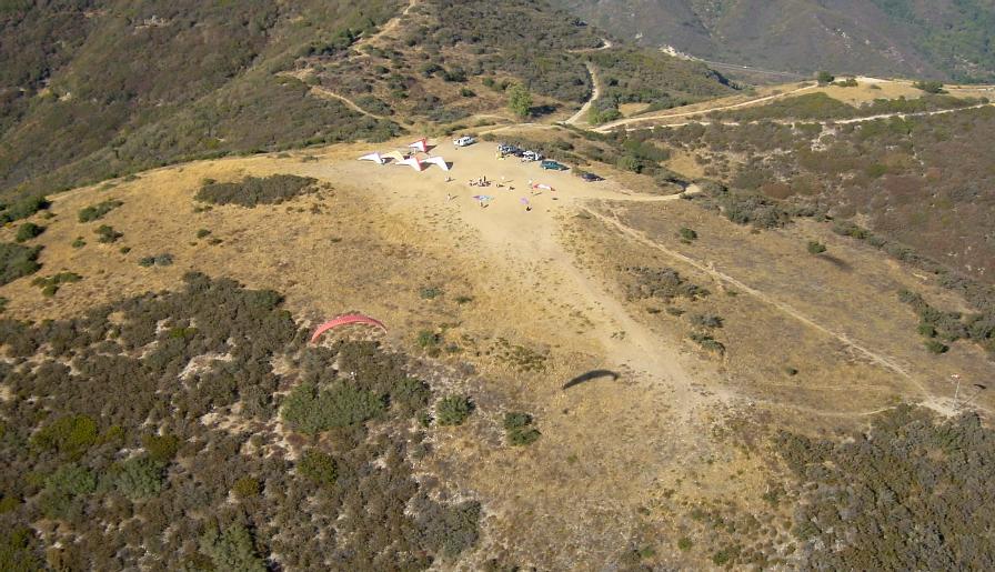
2002/9/14
|
Launch area.
|
|
La zone de décollage.
|
|
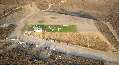
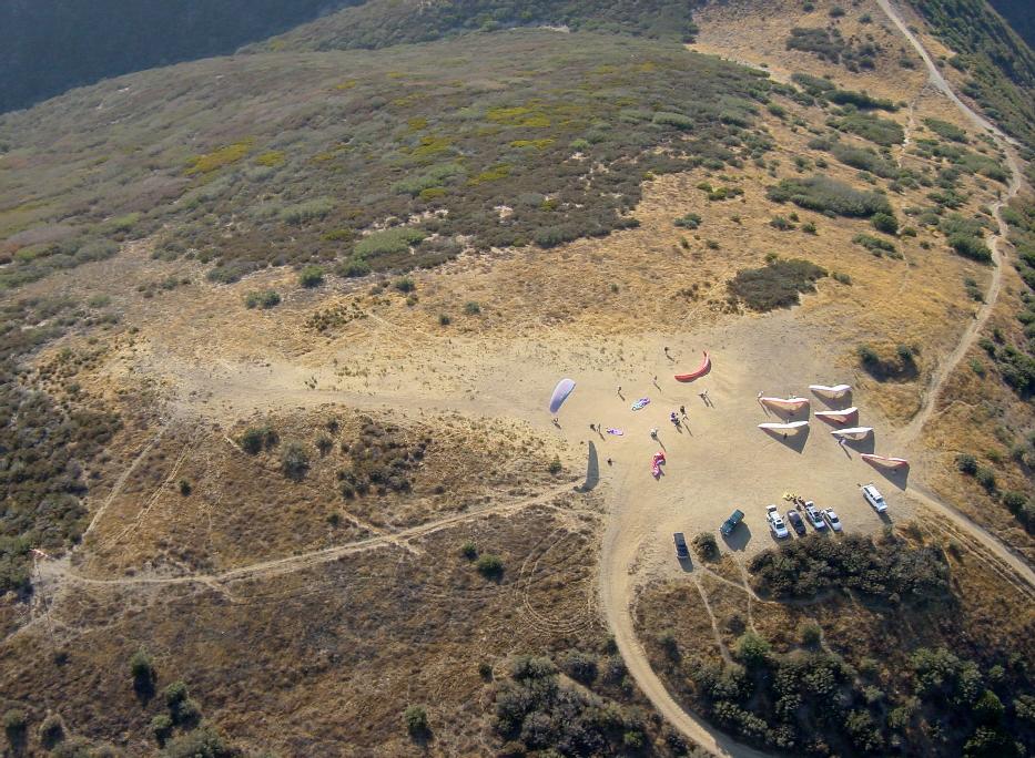
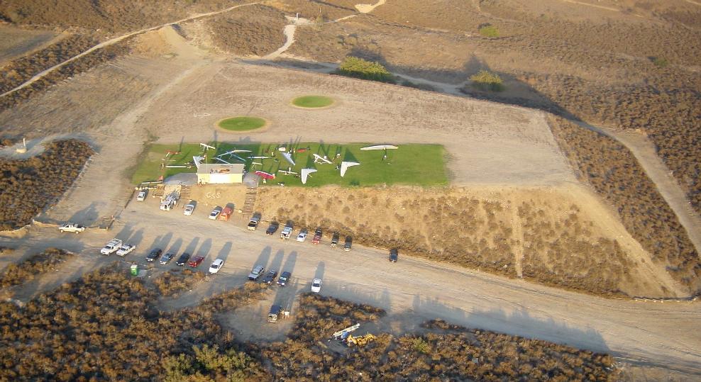
2002/9/14
|
Landing zone.
|
|
La zone d'atterrissage.
|

|
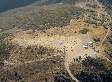
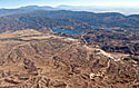
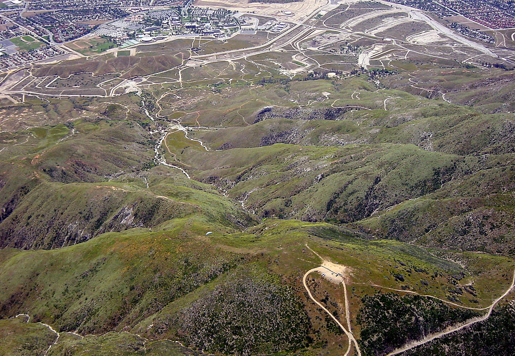
2005/5/21
|
Marshall launch and LZ, then East view.
|
|
Décollage de Marshall et zone d'atterrissage, puis vue vers l'Est.
|
|
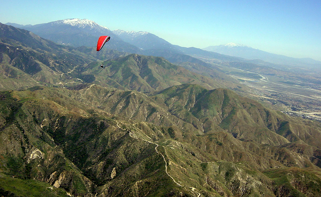
2005/5/21
|
Crestline launch and ridge.
|
|
Décollage de Crestline et falaise.
|
|
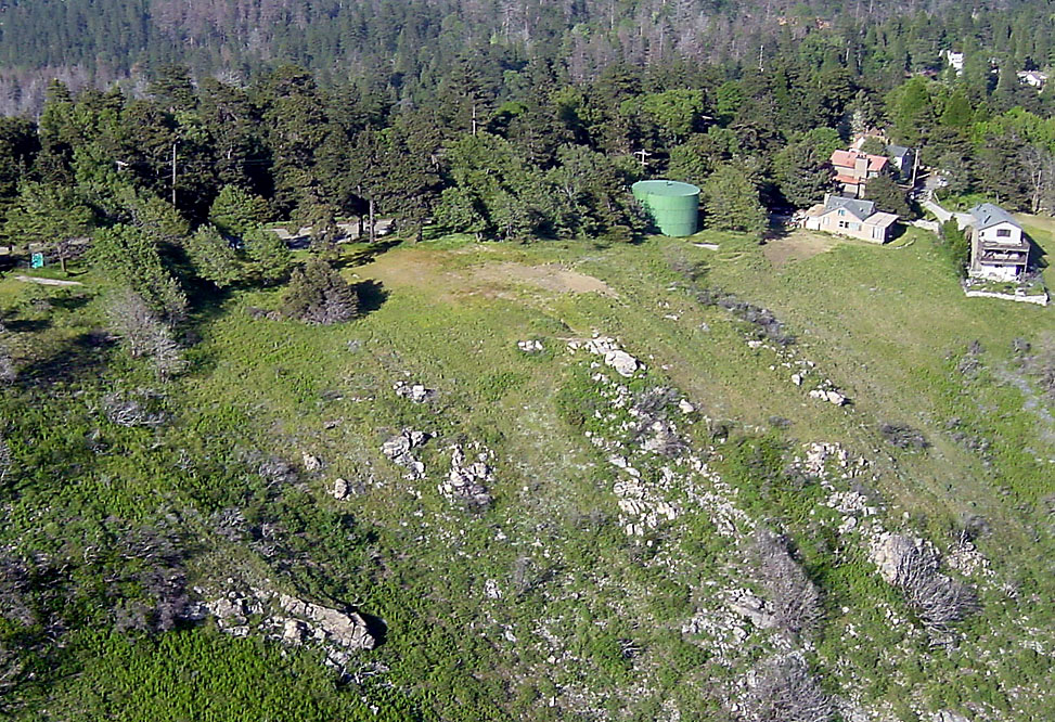
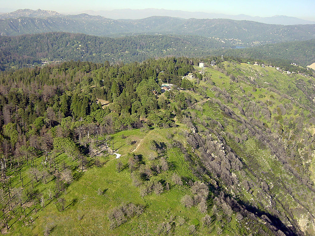
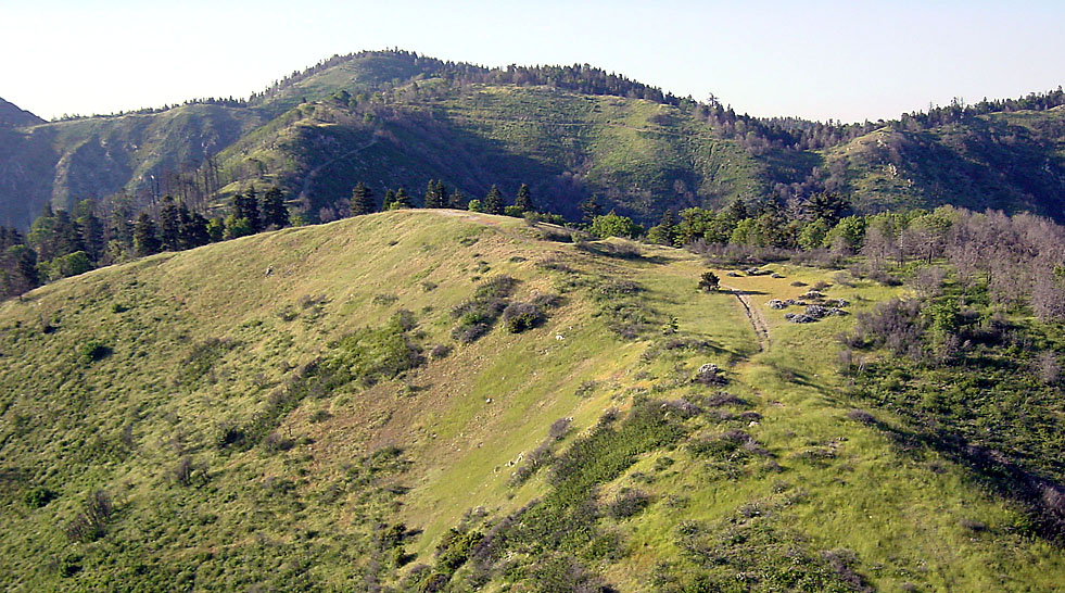
2005/5/21
|
Pine summit.
|
|
Sommet de Pine.
|
|
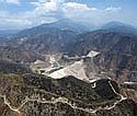
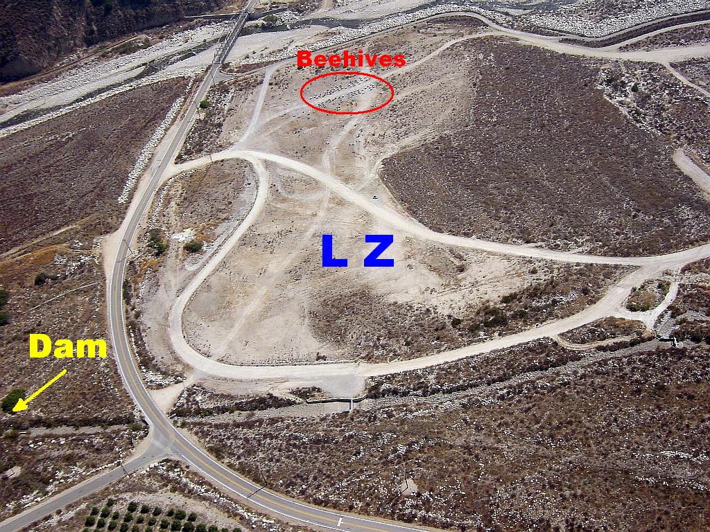
2005/9/10
|
The Seven Oaks dam LZ at the Santa Ana river.
|
|
L'atterrissage du barrage Seven Oaks à la rivière Santa Ana.
|
|
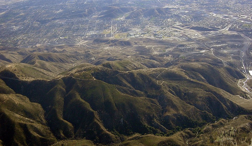
2005/10/1
|
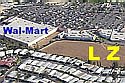
Wal-Mart LZ, just past the casino and Indian reservation,
at the base of McKinley (first big mountain to the East of Marshall).
|
|
L'atterrissage du Wal-Mart, un peu après le casino et la réserve Indienne,
à la base de McKinley (première grosse montagne a l'Est de Marshall).
|
|
2005/12/11
|
Looking East from Crestline at 2300 m (7500').
|
|
Regardant vers l'Est depuis Crestline à 2300 m (7500').
|
|
2005/12/11
|
Looking at Marshall Launch and LZ, from Crestline at 2300 m (7500').
|
|
Regardant le décollage et atterrissage de Marshall, depuis Crestline à 2300 m (7500').
|
|
2005/12/11
|
Arriving at Pine from Crestline, then gaining height and looking forward.
|
|
Arrivée a Pine depuis Crestline, puis gain d'altitude et regard vers l'avant.
|
|
2005/12/11
|
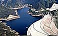
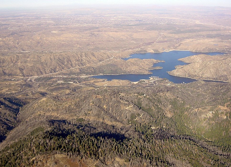
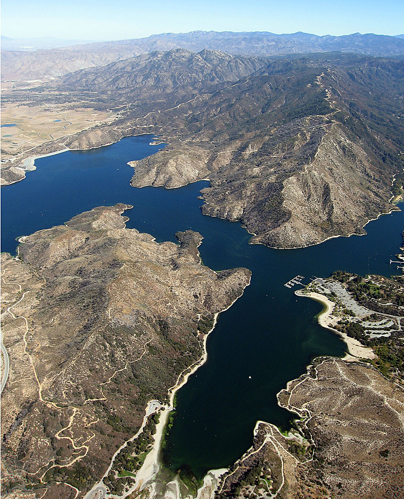
Lake Silverwood, seen from Pine at 2400 m (8000').
|
|
Lac Silverwood, vu depuis Pine à 2400 m (8000').
|
|
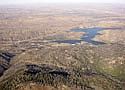
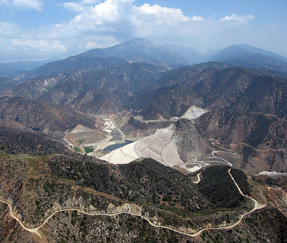
2006/7/8
|
Seven Oaks dam and Mentone Spine launch (lower left).
|
|
Le barrage de Seven Oaks et le décollage Spine de Mentone (en bas à gauche).
|
|
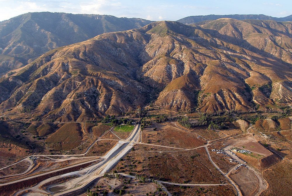
2006/7/8
|
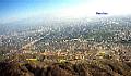
Marshall seen from the valley.
|
|
Marshall vu depuis la vallée.
|

|
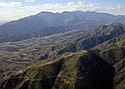
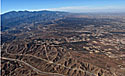
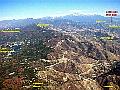
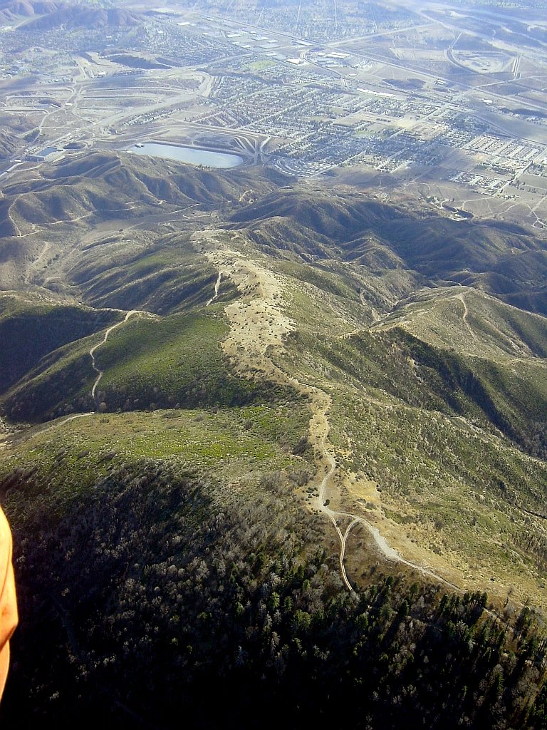
2008/10/17
|
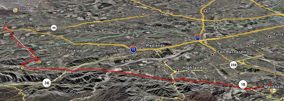
After going "over-the-back"
(flight details):
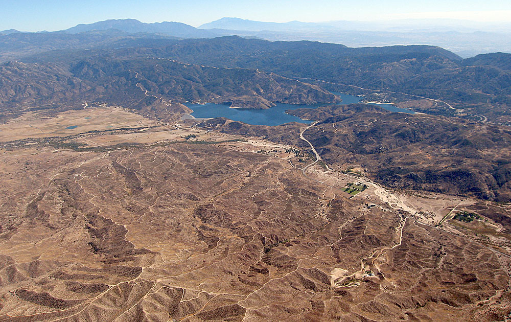
Over the West end of Lake Silverwood, then looking West.
Over Hesperia and looking back towards Lake Silverwood and Crestline.
|
|
Après avoir "sauté les montagnes"
(détails du vol):
Au-dessus l'Ouest de Lake Silverwood, puis regardant vers l'Ouest.
Au-dessus de Hesperia et regardant derrière moi vers Lake Silverwood et Crestline.
|
|
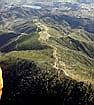
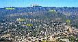
2008/10/25
|
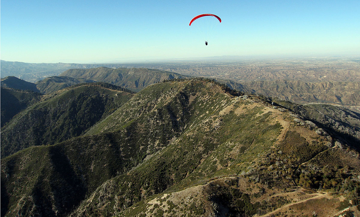
Looking West from Pine.
|
|
Regardant vers l'Ouest depuis Pine.
|
Pictures/Images from others (click thumbnail to open full size image in a new window)
Photos/Images des autres (clique la petite image pour ouvrir la photo pleine grandeur dans une nouvelle fenêtre)
 104 kB
|
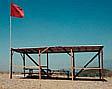
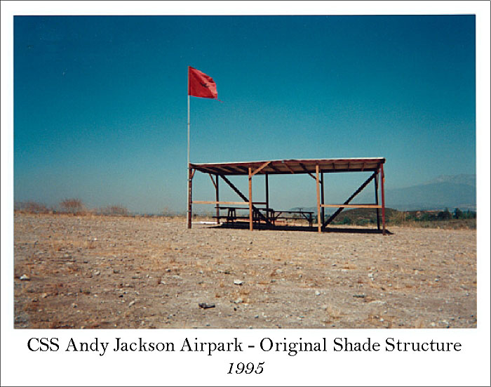
1995
|
The old shade structure in the LZ.
|
|
L'ancien abri-soleil dans l'atterrissage.
|
 223 kB
|
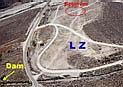
2000/10/17
|
Picture by Stan Koszelak, who went up to 9200', then went for a tour
and looked back at Marshall to take this picture.
I added a few labels.
|
|
Photo par Stan Koszelak, qui a monté jusqu'à 9200',
puis partit faire un tour et se retourna vers Marshall pour prendre cette photo.
J'ai ajouté quelques identificateurs.
|
 72 kB
72 kB
|
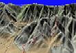
2001/1
|
Stan Koszelak has superimposed a GPS track of a sledder to a
topological map (154 kB)
and rendered it into 3D.
|
|
Stan Koszelak a superimposé un trajet GPS d'un court vol sur une
carte topographique (154 kB)
et lui a donné un renderement 3D.
|
 171 kB
|
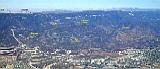
2001/2/16
|
Picture by Stan Koszelak, taken near 7000'.
Strawberry Peak
at the bottom, and
Lake Arrowhead
in the middle.
|
|
Photo par Stan Koszelak, prise à près de 7000'.
Strawberry Peak
en bas, et
Lake Arrowhead
au milieu.
|
Launch
360°
1.13 MB
|
2002/2
|
360° panorama of launch.
QuickTime required.
Click and drag the left mouse button to change the view.
Thanks to Thermal Dynamics.
|
|
Panorama 360° du décollage.
QuickTime requis.
Clique et traîne le bouton gauche de la souris pour changer le point de vue.
Merci à Thermal Dynamics.
|
LZ
360°
1.40 MB
|
2002/2
|
360° panorama of the landing zone.
QuickTime required.
Click and drag the left mouse button to change the view.
Thanks to Thermal Dynamics.
|
|
Panorama 360° de l'atterrissage.
QuickTime requis.
Clique et traîne le bouton gauche de la souris pour changer le point de vue.
Merci à Thermal Dynamics.
|
 426 kB
 258 kB
|
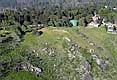
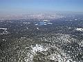
2004/3/20
|
Picture by Rod Clark, taken at 10260' MSL.
I added a few labels.
Related:
I fly from Crestline to the Dam, and top-land Marshall (2004/3/20): 45 km (28 miles).
|
|
Photo par Rod Clark, prise à 10260' MSL.
J'ai ajouté quelques identificateurs.
|
 358 kB
|
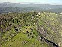
2004/3/20
|
Picture by Stan Koszelak.
I added a few labels.
Related:
I fly from Crestline to the Dam, and top-land Marshall (2004/3/20): 45 km (28 miles).
|
|
Photo par Stan Koszelak.
J'ai ajouté quelques identificateurs.
|

|
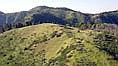
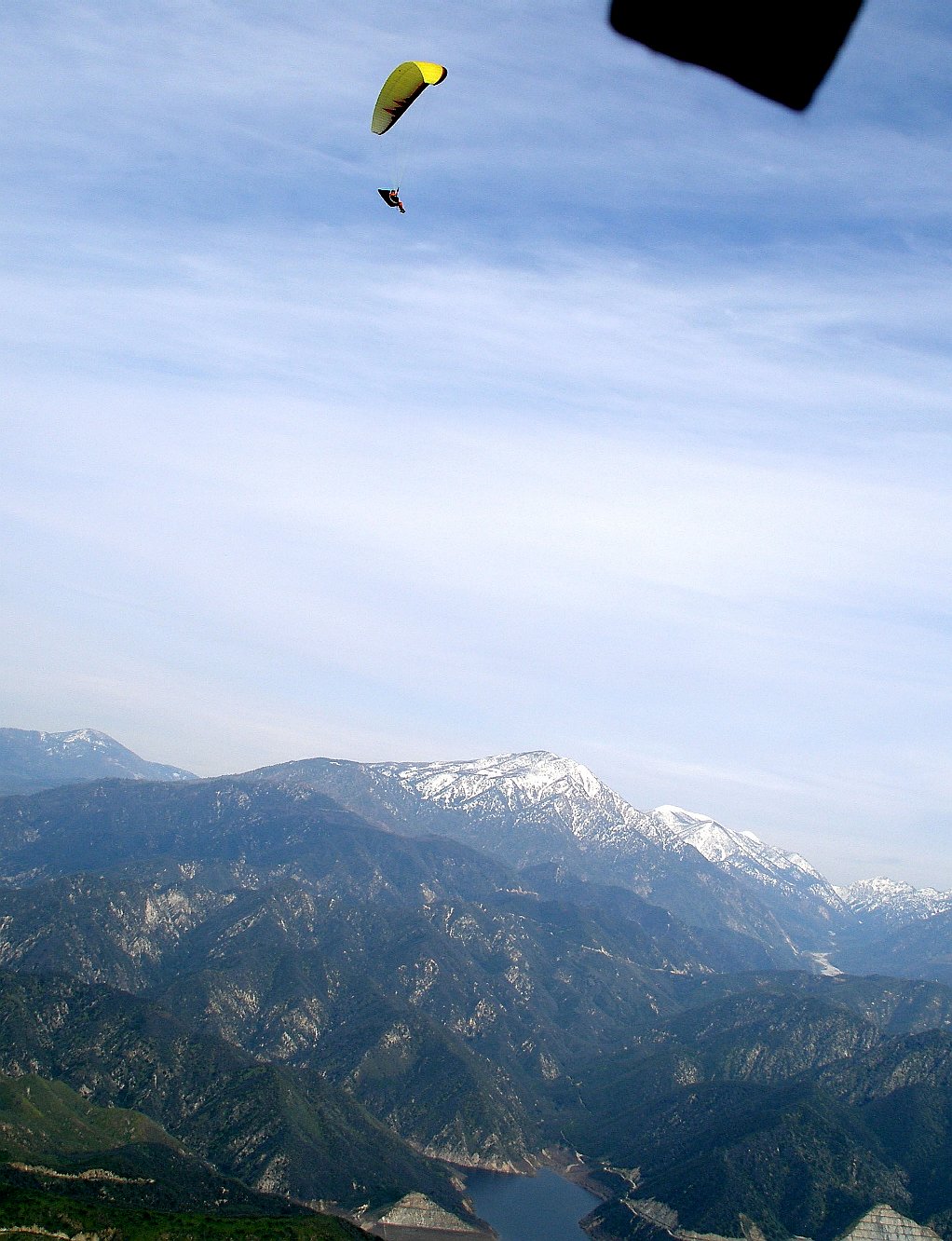
2004/3/20
|
Pictures by Bob Barry during a flight from Marshall, taken at 5000' MSL.
I'm the guy with the yellow wing.
This is the Santa Ana river dam area, about 13 miles East of Marshall.
Mentone launch is the short dirt strip at the road bend.
|
|
Photos par Bob Barry durant un vol depuis Marshall, prise à 5000' MSL.
Je suis le gars avec l'aile jaune.
C'est le barrage de la rivière Santa Ana, 13 miles à l'Est de Marshall.
Le décollage de Mentone, c'est la courte piste de terre dans le virage de la route.
|


 104 kB
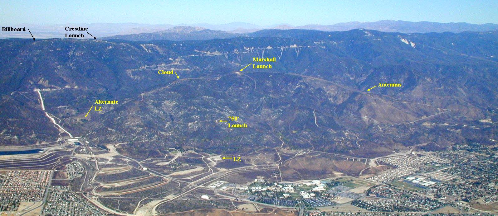 223 kB
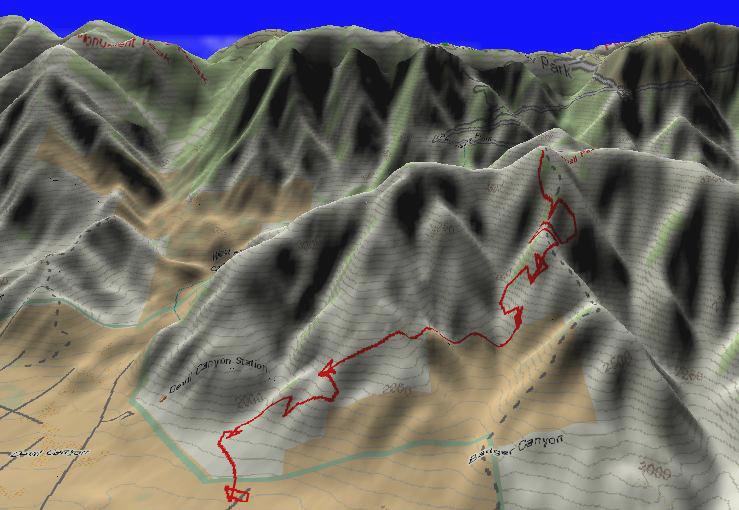 72 kB
72 kB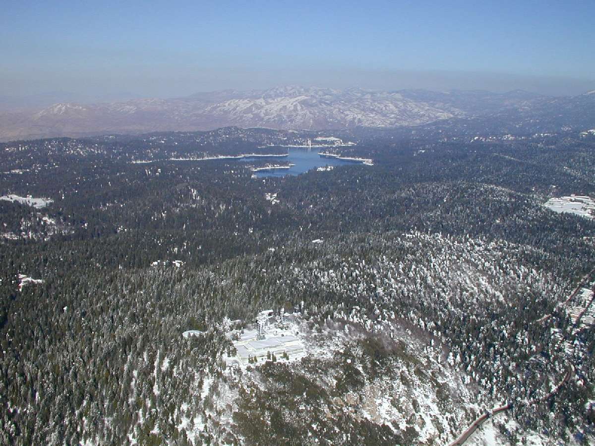 171 kB
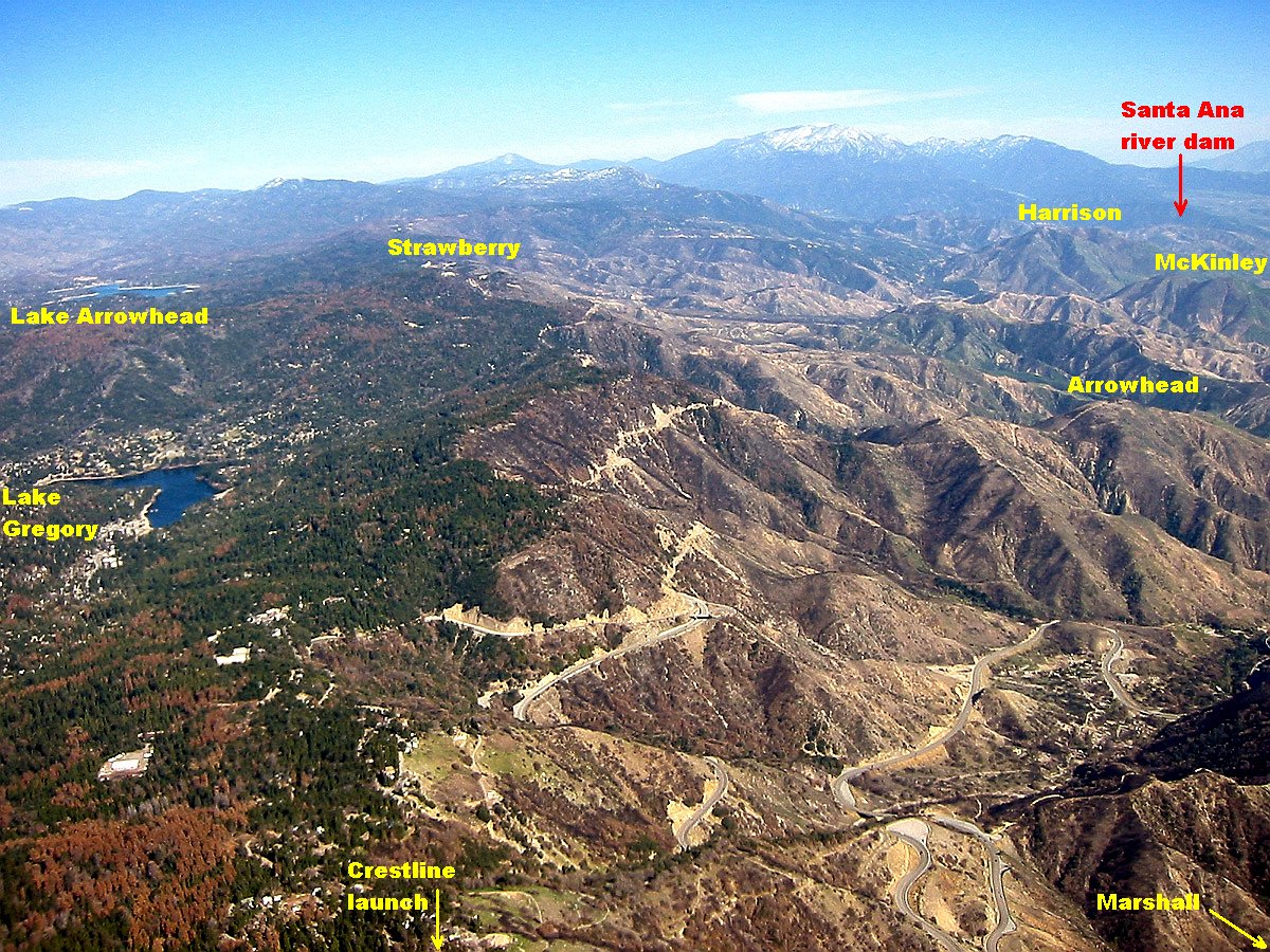 426 kB
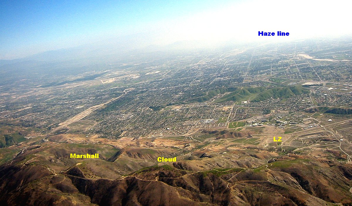 258 kB
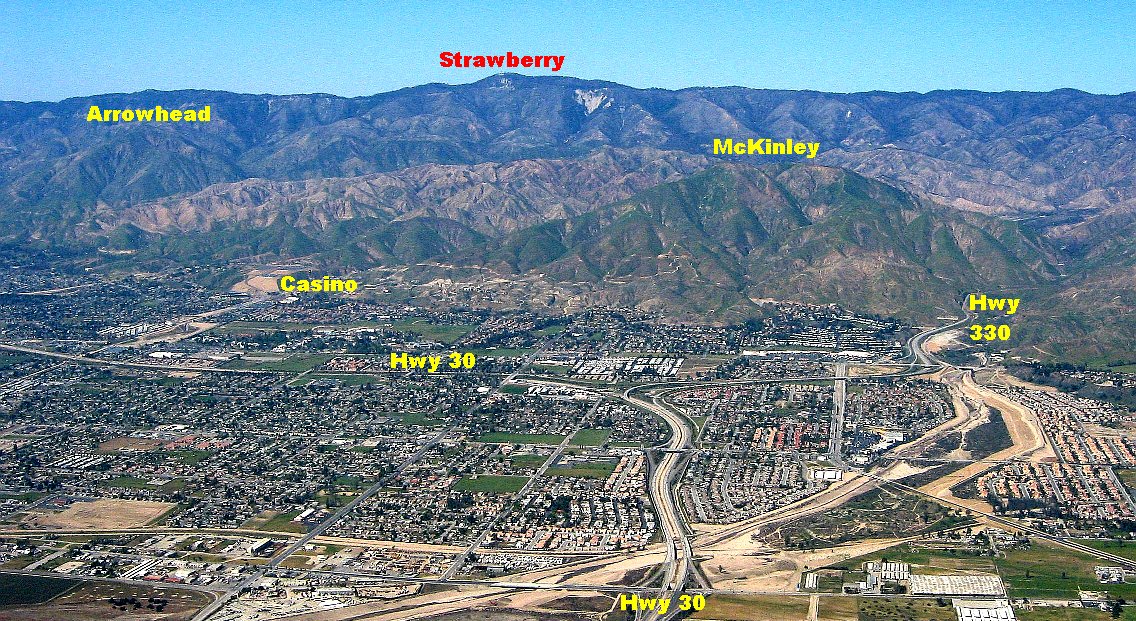 358 kB
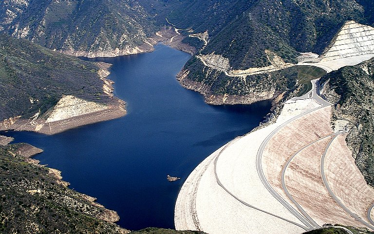
