Flying site / Site de vol
Torrey Pines, California, USA
Jérôme Daoust
( E-mail )
2026/6/2
-
Conditions
-
The club supporting the site / Le club supportant le site :
Torrey Pines Gliderport.
-
Events / Evénement :
Torrey Pines Gliderport.
-
Bulletin board / Tableau d'affichage :
None.
-
Articles
-
Schools / Ecoles
-
Lost and Found / Object perdu ou retrouvé :
No info.
-
How to get there / Comment s'y rendre :
Torrey Pines Gliderport.
-
Maps / Cartes
-
GPS coordinates / Coordonnées GPS
-
Site frequency / Fréquence du site :
151.625 .
-
Insurance / Assurances
-
Lodging / Hébergement
-
Restaurant :
No info.
-
Car rental / Location d'auto :
Local car rental agencies
-
Image
-
Video or Animation / Vidéo ou Animation
-
Cross Country / Vol Voyage
-
Hazards / Dangers
Conditions
We are hoping for West winds (270 degree) ± 45 degree, at least 10 km/h (6 mph).
By order of interest:
-
Forecast:
-
Windgram, for wind direction and altitude ceilings:
Soaring Predictor
(click "Torrey",
Archive).
Understanding "Wind Barbs".
Alternate website(s):
FlyMarshall.
-
RASP (Regional Atmospheric Soaring Predictor) for Southern California:
Soaring Predictor
(Older version).
Typical sequence:
-
Select day and time.
-
Select a parameter like "Sfc.Wind (10m)".
-
To change the opacity of the data layer:
Click the "+" or "-" icons in lower right
(Old version: Use slider in the upper right, or mouse's center wheel).
-
Finding flying sites:
Click the layer icon in the upper right, enable the "Sounding/SkewT".
Hover your mouse pointer over the markers, names appear.
Alternate website(s):
FlyMarshall.
-
Soaring Predictor
(updated daily at 7:30 AM).
-
San Diego forecast (NOAA):
Hourly.
Definition: Wind Barbs.
-
La Jolla forecast (Weather Underground):
Hourly,
10 days.
-
La Jolla forecast (Weather.com):
Hourly,
15 days.
-
Graph of HRRR data and same-day forecast:
Mobile version by David Webb.
-
Forecast Discussion - San Diego (NOAA).
-
Ask someone at the shop for a daily forecast : 858-452-9858.
But don't talk too long and tie up the line.
-
6 hour,
12 hour,
24 hour
Wind forecast - San Diego (Airsports Network).
-
Look for a fire nearby (associated air traffic):
-
Look for a TFR (Temporary Flight Restriction):
-
SkyVector.
-
SoaringData. Transforms local TFRs into a KML file for visualization in Google Earth:
-
Center airport identifier: san (San Diego International)
-
Bounding radius (stat. miles): 100
-
Airspace in Google Earth KML format
-
Append special use and ATC-controlled airspace uncheked
-
Type "Soar" into this box: Soar and press Submit
-
SoarCal / TFR. Click the map icon to visualize the TFR over a map.
-
FAA / TFR. Set "State" to "California", then click "GO" next to it.
-
Current :
Articles
Schools / Ecoles
for paragliding operating at this site.
Ordered alphabetically / Ordonné alphabétiquement :
Maps / Cartes
-
Google Earth:
Local points of interest.
A great way to explore this flying site in 3D.
-
Google - Satellite:
Launch.
You can drag the map with your mouse.
GPS coordinates / Coordonnées GPS
| Description |
Latitude |
Longitude |
Altitude (ASL) |
| Pilot parking lot |
N 32° 53.397' |
W 117° 15.031' |
102 m (GPS***) |
333' (GPS***) |
| Launch (center of sloped face) |
N 32° 53.408' |
W 117° 15.089' |
95 m (GPS**) |
310' (GPS**) |
| Beach : Start of trail up to launch |
|
|
5 m (GPS**) |
16' (GPS**) |
* GPS = Br uniger / Competino, using WGS84.
WGS84 (World Geodetic System 1984) is the Standard Geodetic Datum & the common reference datum
used for civilian aviation world wide.
More info:
Mean Sea Level, GPS, and the Geoid.
** Google Earth, 2005/9/5.
*** Garmin StreetPilot 2620.
For a great way to explore this flying site in 3D,
see Google Earth's Local points of interest in the
Maps section.
Insurance / Assurances
-
You will need to become a USHPA member and it's not expensive
for the 1 month membership.
Just contact one of the
Schools
so you can take the one month membership for 10$.
It is good all over the US for the 30 day period.
-
Tu devras devenir un membre de l'USHPA et ce n'est pas cher
pour être membre pour un mois.
Tu as juste à contacter une des
Ecoles
afin de prendre le membersip d'un mois pour 10$.
Ce sera bon pour tous les sites aux Etats-Unis pour une
période de 30 jours.
Lodging / Hébergement
Image
Pictures I took (click thumbnail to open full size image in a new window)
Photos que j'ai prises (clique la petite image pour ouvrir la photo pleine grandeur dans une nouvelle fenêtre)

|
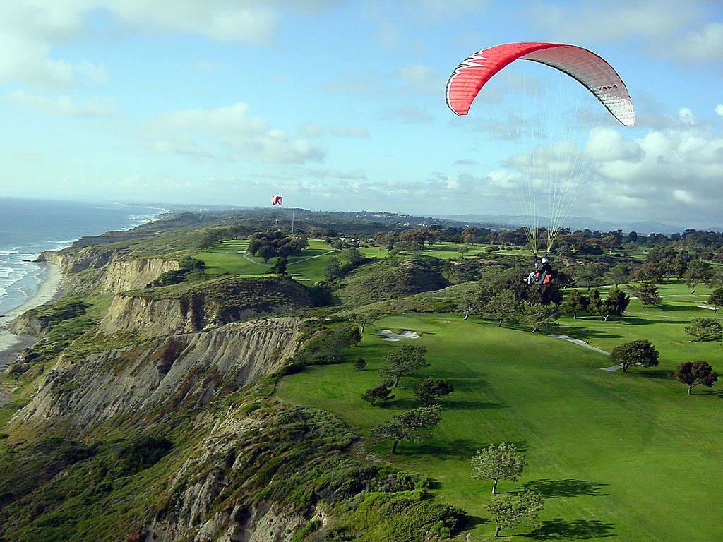
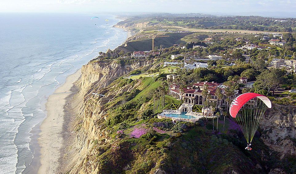
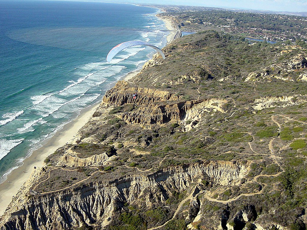
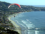
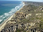
2005/4/24
|
Launch.
Golf course.
Mansions.
Pier.
|
Décollage.
Terrain de golf.
Mansions.
Jetée.
|
|
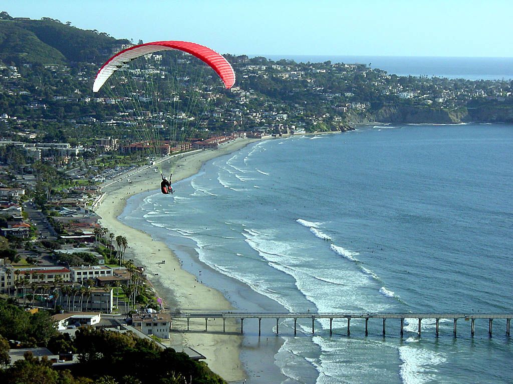
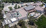
2005/6/18
|
Aquarium (behind pier).
Launch and North.
Park North end.
|
Aquarium( derrière la jetée).
Décollage et au Nord.
Extrémité Nord du park.
|
|
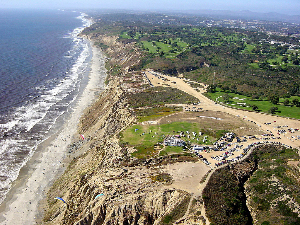
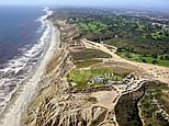
2006/2/20
|
Arriving at the park's North end.
|
|
Approche de l'extrémité Nord du park.
|
|
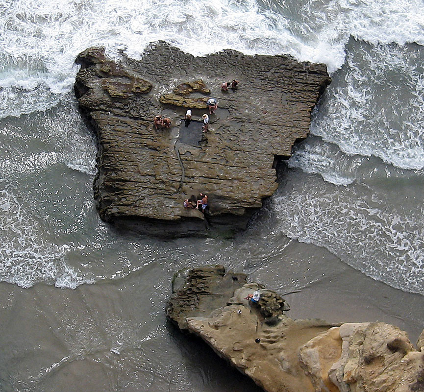
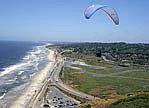
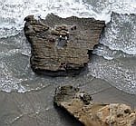
2006/7/29
|
People playing at Bathtub Rock (North of the golf course).
|
|
Des gens s'amusent a Bathtub Rock (au Nord du terrain de golf).
|
Personal pages :
Video or Animation / Vidéo ou Animation
Cross Country / Vol Voyage
Before you go, know your airspace. For Google Earth:
California 3D overlay for classes B/C/D and restricted military airspace.
Hazards / Dangers
-
Pilot attitudes, specially on busy weekends.
Simultaneous use in ocean ridge lift, of paragliders, hangliders, sailplanes,
radio controled sailplanes.
Rules which are particular to the site
(example : Tandems gain priority during light wind).
-
Attitudes des pilotes, surtout lors des weekends achalandés.
Usage simultané en vol de bord de mer, de parapentes, deltaplanes, planeurs,
planeurs télécommandés.
Règles particulières au site
(exemple : Les tandems deviennent prioritaires par vent faible).