Back to Marshall : Cross Country / Vol Voyage
May 2, 2004 : Crestline à Littlerock
Flight by Andre Dreyer, edited by Jérôme Daoust.
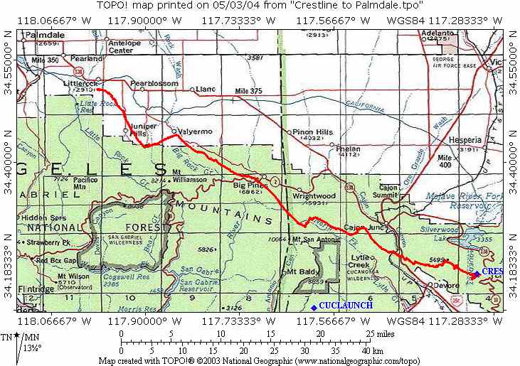
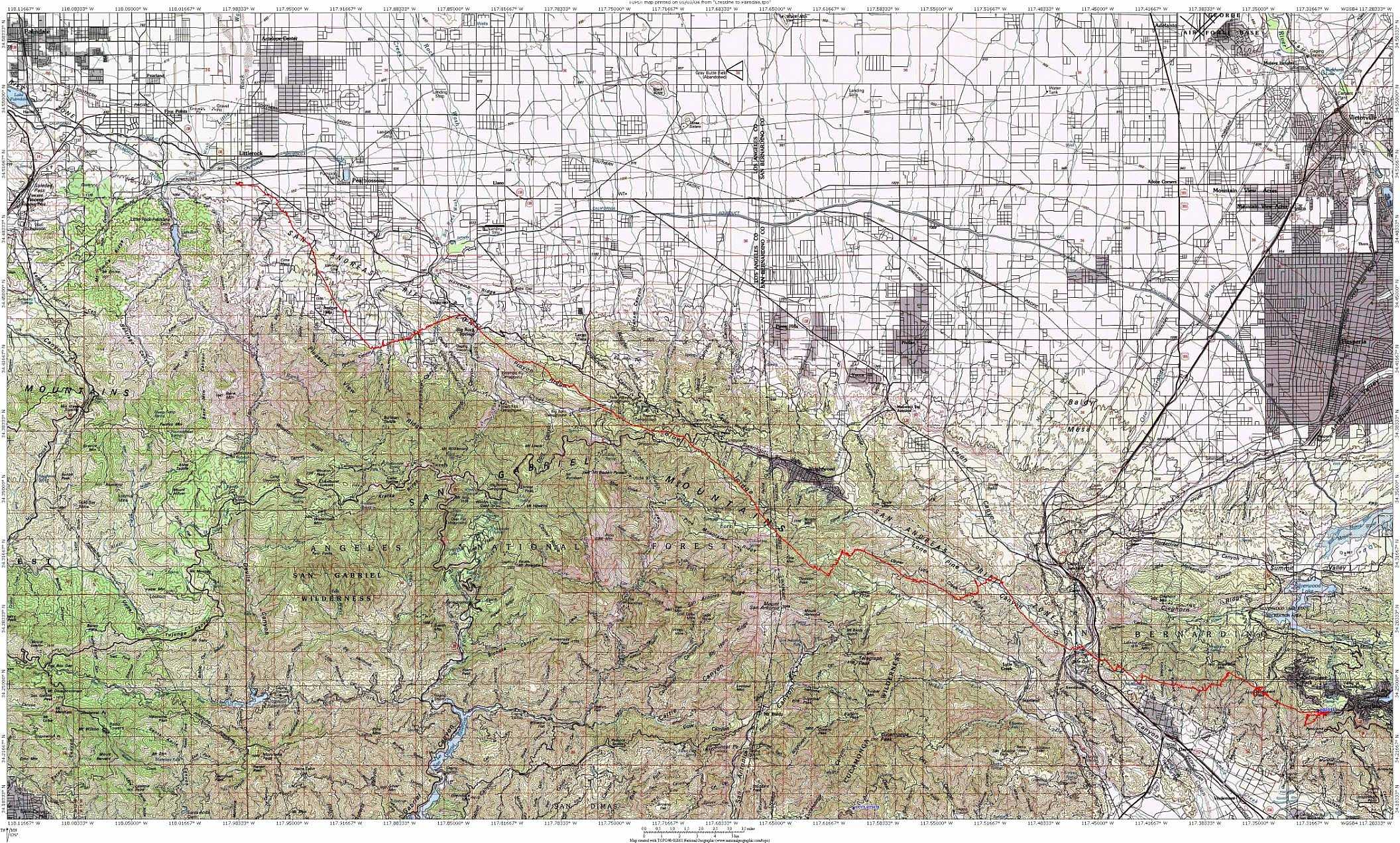
Topographic maps with flight path : Small , Large.
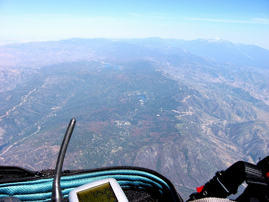
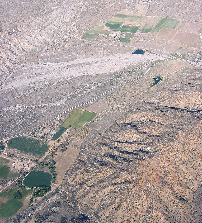
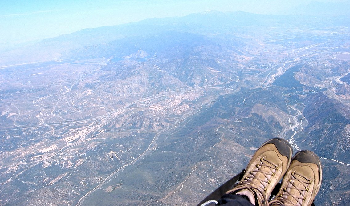
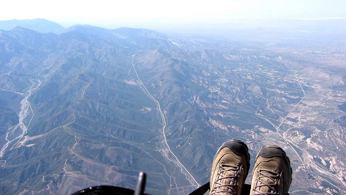
A beautiful sunny day at Crestline. Launched just behind Gavin at 1:50 pm. 10.5k directly above launch and then 13k at Sugarpine Mountain (View of Crestline). Going NW with a slight tailwind above Devore. Met up with Gavin at 15 / 138 where we were working light lift trying to top up the altitude for the high country towards Wrightwood. Hoping to follow the 138 but found BIG sink instead (Low at Lone Pine). The ridge S of Lone Pine Canyon was working better (Back up at Lone Pine) and Wendee and Gavin’s dad diverted to the road with the same name. Pictures : Cajon Pass and looking back, Cucamonga (left) and San Antonio (right) , After San Antonio.
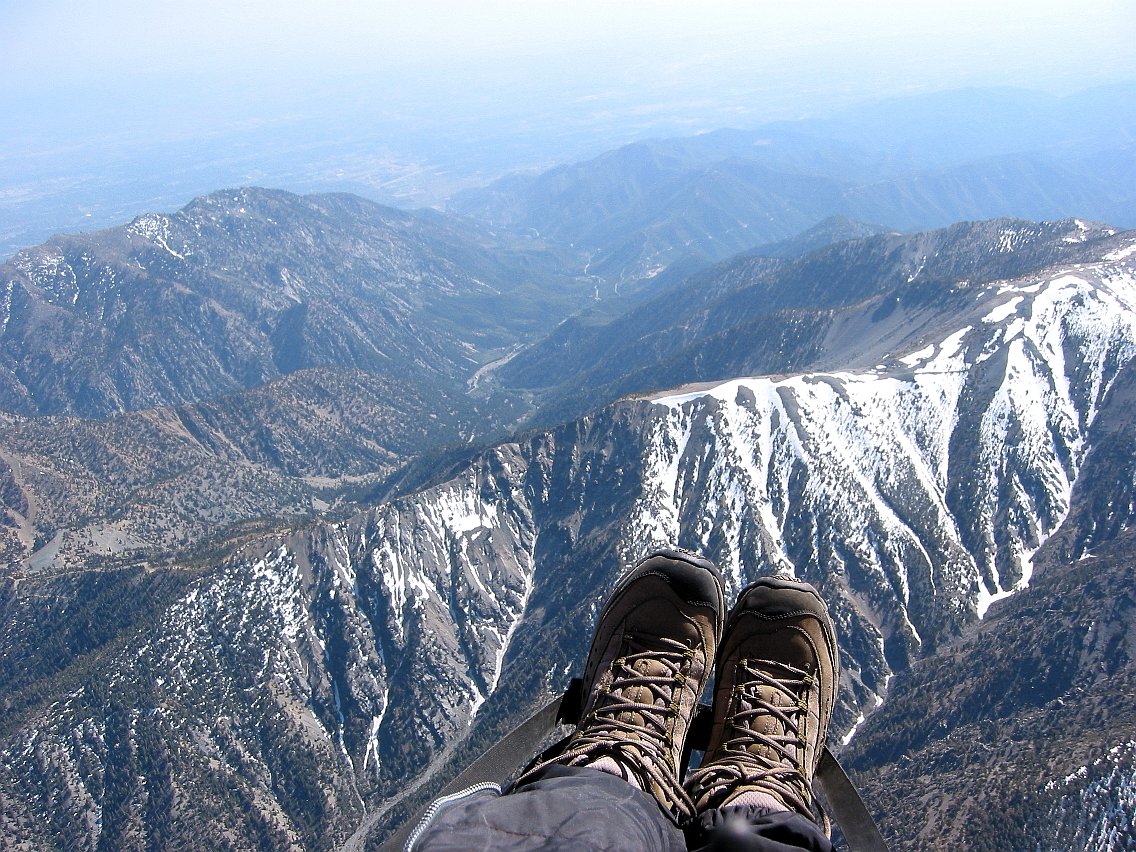
Big one directly above Pauite Campground all the way to 14.9k in front of Dawson Peak. Great view of snow covered Mount Harwood and Devils Backbone. Crossed over Pine mountain (this one is at 9648ft) and followed the ridge S of Hwy 2 and later Big Pine Hwy. I was pretty low at Mountain High ski resort with the only bail out being the parking lot surrounded by big trees. Luckily a slow drifter got me out and on track again.
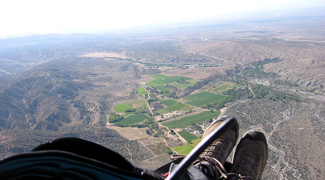
A low save (thanks to some birds) at Valyermo and up to mid 12’s aiming for Palmdale. I could see the hazy W wind approaching and soon after started hitting a headwind. Unfortunately my DHV 1/2 is not the best on speed bar and my glide dropped to 3:1
Landed in Little Rock on the outskirts of Palmdale. 5:30 pm. 42 miles 3 ½ hours
What a fantastic weekend, more than 100 miles in 2 days (Previous day). Thanks for all the driving to Wendee and Gavin’s parents.